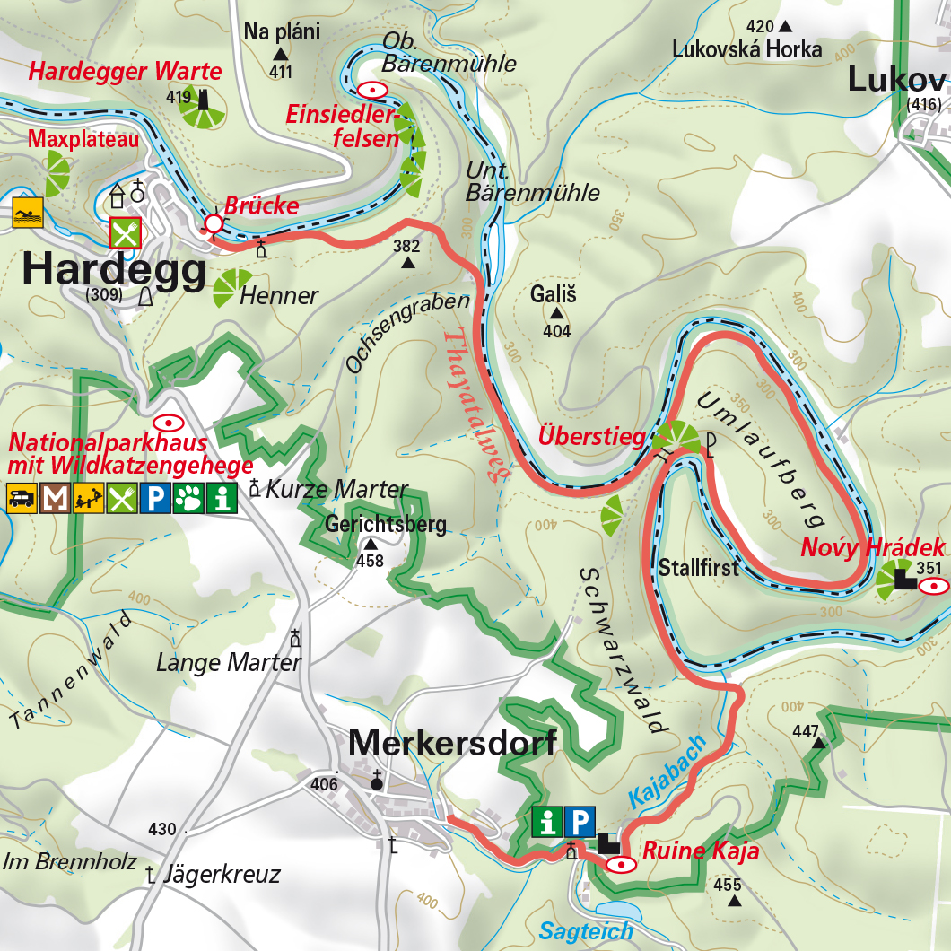
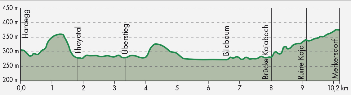
Thayabrücke in Hardegg - follow the Thaya downstream to the crossing - cross the Überstieg or take the Umlaufberg (this alternate route around the mountain is approx. 1 h longer) - Kajabachtal - Ruine Kaja - 4 km return from Merkersdorf via the trail next to the main road.
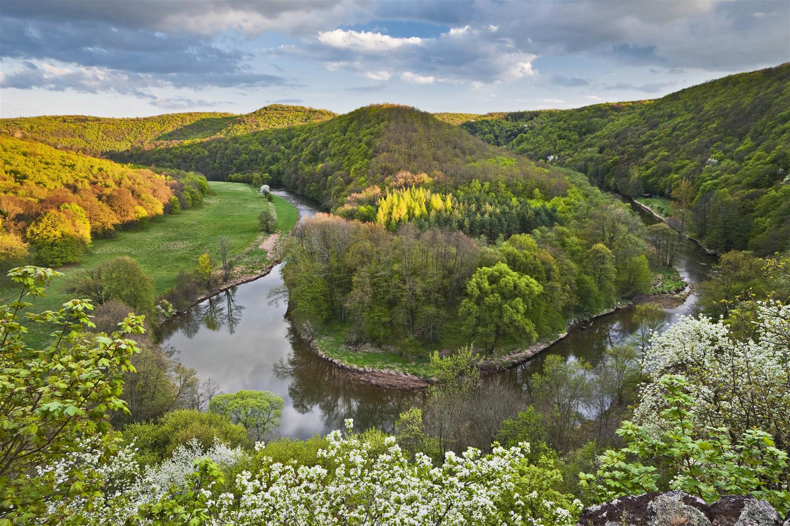
- View from the Umlaufberg to the Green Canyon and the meanders of the Thaya
- Possibility of seeing emerald lizards
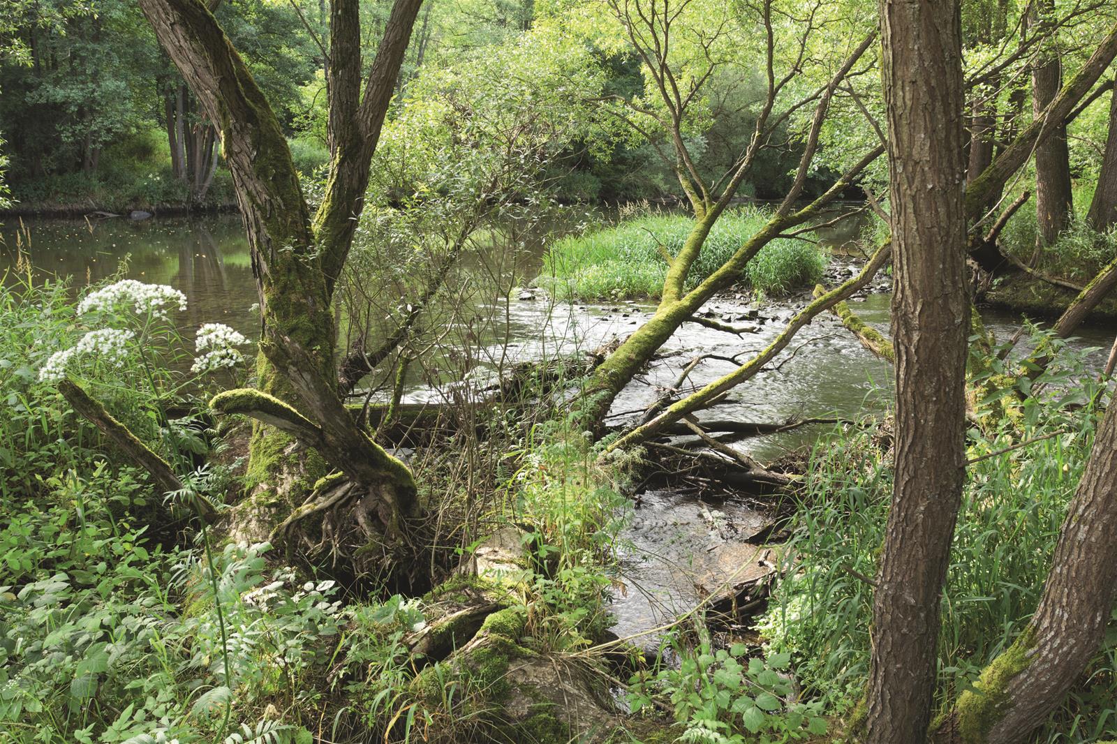
- Picturesque mouth of the Kajabach where it joins the Thaya
The starting point is the Thayabrücke in Hardegg. Via the Gabrielensteig (Gabriel's Climb) - the word "Climb” warns you - the trail first leads steeply uphill over a mountain ridge, but soon goes downhill again towards the river, which you follow for long stretches. The comfortable way: it stays refreshingly cool right next to the Thaya, even in the height of summer.
The following section - next to the Thaya, at the foot of the Ochsengraben and Bossengraben to the Überstieg - has a very primordial character. Here you can experience the developing wilderness at first hand, right in the middle of the Green Canyon.
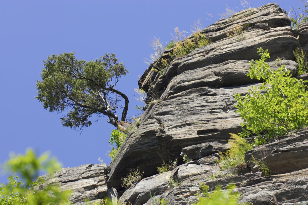
At the crossing, you have the choice of shortening the route or going via the Umlaufberg loop. The fantastic view along the Umlaufberg loop, accessible via the Überstieg, should not be missed. Only from a bird's eye view do the dimensions of the valley and the meanders of the Thaya really become apparent. A must-see!
At the same time, there's a chance of coming across sunbathing emerald lizards here. Colourful irises thrive alongside dry-loving oaks, junipers and pines. At the foot of the Umlaufberg, the chances of sighting Aesculapian snakes are good, while the meadows along the Thaya are full of life in summer.
The Thayatalweg branches off into the shady Kajabach valley at the point where the Kajabach flows into the Thaya. Many maples, alders and elms thrive here alongside old stands of copper beech. The clean stream is also home to a Thayatal star: the noble crayfish. You slowly emerge from the valley again, hiking slightly uphill until the ruins of Kaja Castle emerge from the greenery.
The way back leads along the trail next to the main road from Merkersdorf towards the Nationalparkhaus (National Park House) and the Kirchensteig down to Hardegg (+ 4 km/+ 1 h). Buses run daily, if infrequently, during the season. Timetables can be requested at the Nationalparkhaus or from ÖBB (Austrian Railways).