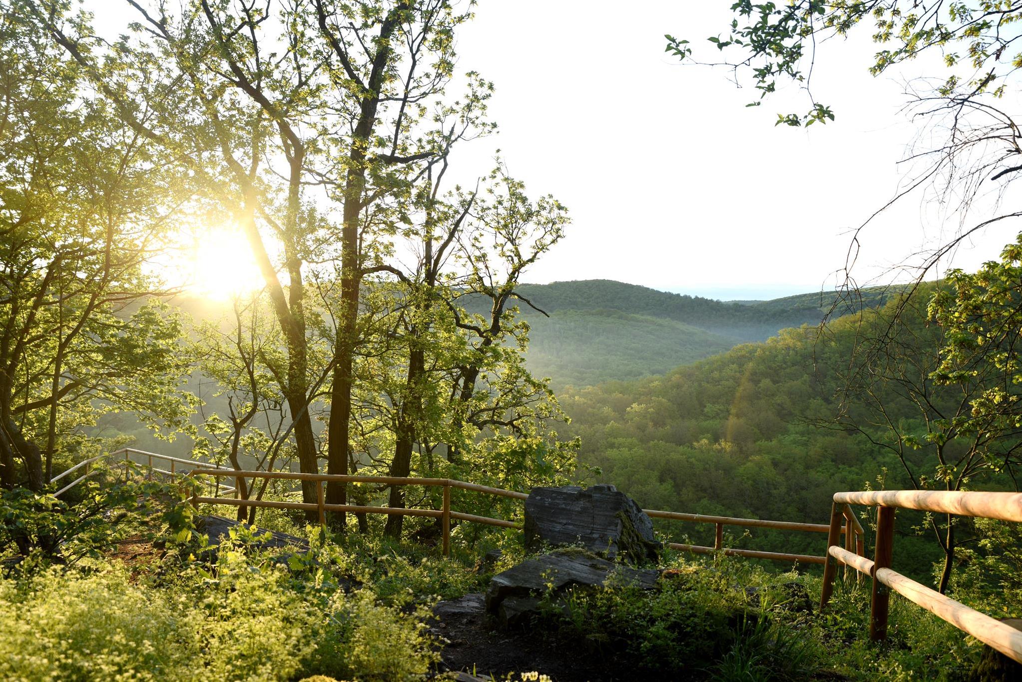
This trail offers magnificent views from two vantage points high above the Thaya. However, these also have to be climbed, which requires some surefootedness.
Route
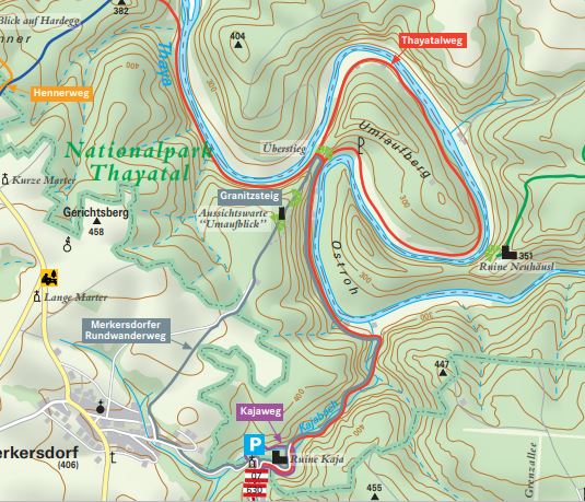
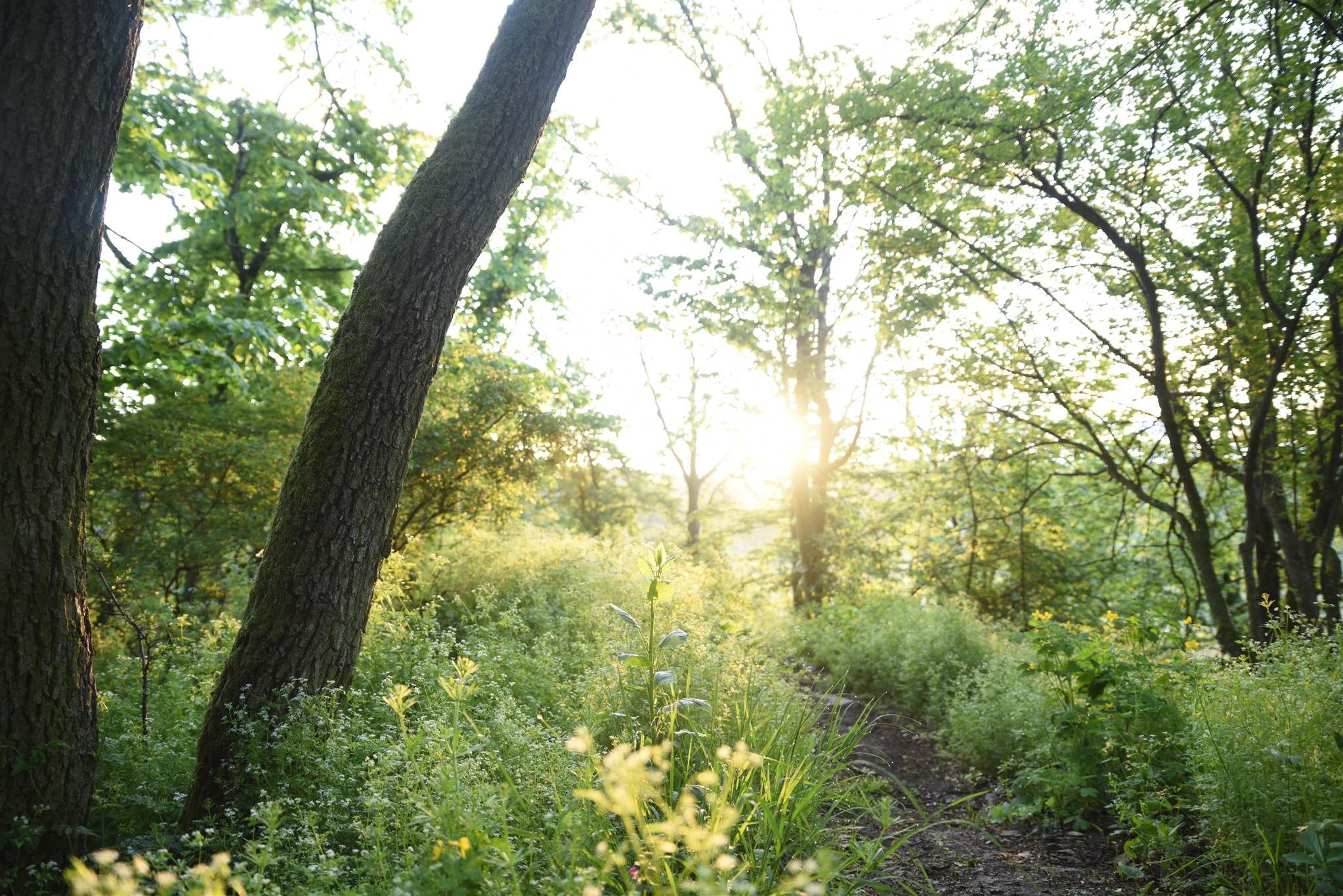
Ruine Kaja car park - through the Kajabach valley to the Thaya - upstream to the crossing - crossing - down the other side (alternatively around the Umlaufberg) - briefly along the Thaya - left up the granite path - back via Merkersdorf.
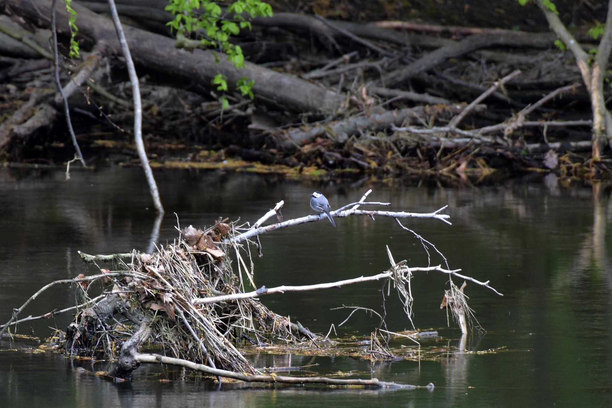
We recommend lingering a while once you get there. With a bit of luck, a kingfisher will whiz by during your short break. Sightings of otters or black storks are also possible here.
At a fork a little way upstream, you finally have to make a decision.
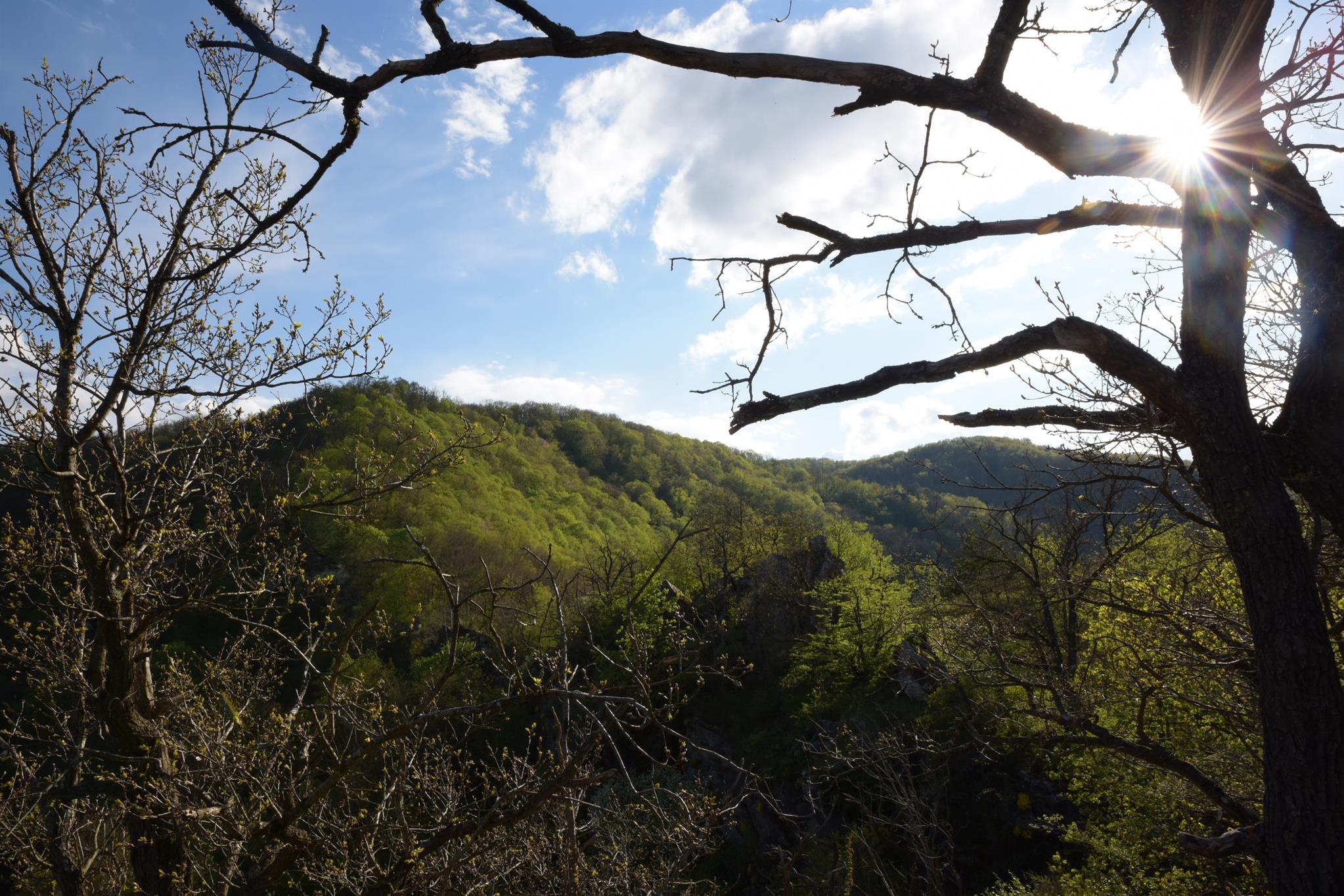
Variant 1 follows the grey marking throughout. It is shorter but challenges hikers with two steep climbs. Once you reach the top, you are rewarded with a wonderful view of the Thaya, once from the crossing and twice from the granite path.
Variant 2 is longer and has only one ascent. At the fork, just continue straight ahead, upstream along the red markings. Directly below the crossing viewpoint, it's only a few minutes to the Schlangenfelsen (Snake Rock). Emerald lizards and Aesculapian snakes like to soak up the sun here.
It takes about 45 minutes to walk the Thaya Loop around the Umlaufberg, once with the sun in your face, once on your back. Eventually you meet the grey markings again, where the path comes down from the crossing.
At the next junction a little way upstream, you now walk steeply uphill along the granite path. In spring, the slope here is covered with liverworts and the wild garlic exudes its distinctive scent. At one point you can get a bird's eye view of the Thaya and enjoy the sight before returning to Merkersdorf along a field path.
Highlights
- View from the new ,,Umlaufblick'' viewing platform
- View from the Überstieg
Trail directions
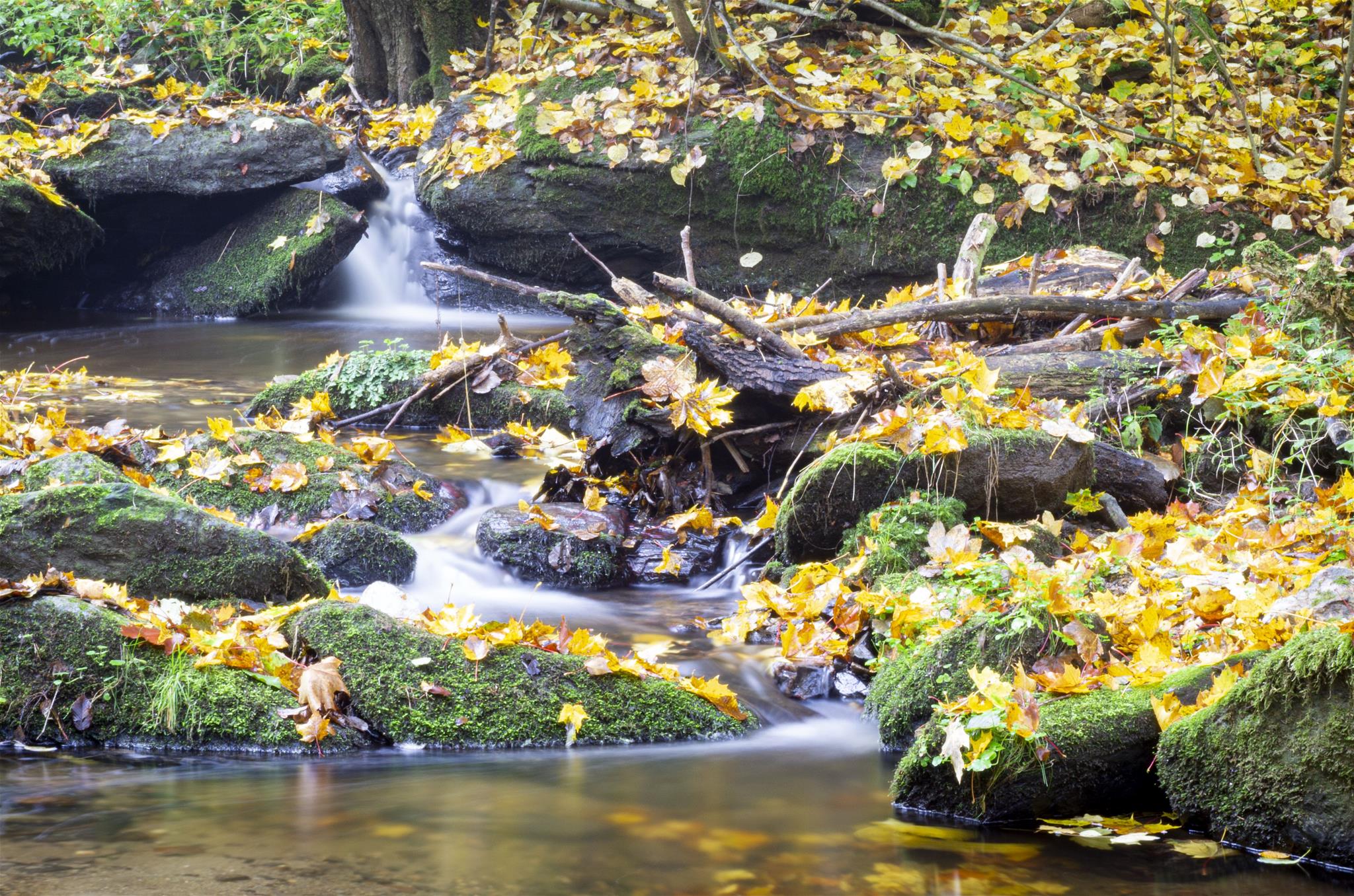
Do you prefer "short and sweet” or a little longer and more leisurely? The Merkersdorf loop trail gives you a choice. First, however - as with the Kaja trail - you take the meadow path at the end of the Ruine Kaja car park into the forest. Where the Kajabach and Merkersdorferbach meet, the grey-marked hiking trail branches off to the left and follows the rippling of the Kajabach to the point where it flows into the Thaya.We recommend lingering a while once you get there. With a bit of luck, a kingfisher will whiz by during your short break. Sightings of otters or black storks are also possible here.
At a fork a little way upstream, you finally have to make a decision.
Variant 1 follows the grey marking throughout. It is shorter but challenges hikers with two steep climbs. Once you reach the top, you are rewarded with a wonderful view of the Thaya, once from the crossing and twice from the granite path.
Variant 2 is longer and has only one ascent. At the fork, just continue straight ahead, upstream along the red markings. Directly below the crossing viewpoint, it's only a few minutes to the Schlangenfelsen (Snake Rock). Emerald lizards and Aesculapian snakes like to soak up the sun here.
It takes about 45 minutes to walk the Thaya Loop around the Umlaufberg, once with the sun in your face, once on your back. Eventually you meet the grey markings again, where the path comes down from the crossing.
At the next junction a little way upstream, you now walk steeply uphill along the granite path. In spring, the slope here is covered with liverworts and the wild garlic exudes its distinctive scent. At one point you can get a bird's eye view of the Thaya and enjoy the sight before returning to Merkersdorf along a field path.
Public transport
If you arrive by bus, walk down the alley from the Merkersdorf bus stop towards the Ruine Kaja. After about one kilometre, you'll come to the Ruine Kaja car park.Features and tour dates
Marking: grey, loop red
Starting point: Ruine Kaja car park
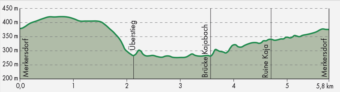
Trail length: via Überstieg (crossing) 5 km, with Umlaufschleife (loop) 8.5 km
Walking time: 1.5 h via the crossing, 2.5 h with loop
Ascent: 231 m
Descent: 233 m
Height: maximum 422 m, minimum 276 m
Difficulty: medium, some steep, rocky sections
Starting point: Ruine Kaja car park
Trail length: via Überstieg (crossing) 5 km, with Umlaufschleife (loop) 8.5 km
Walking time: 1.5 h via the crossing, 2.5 h with loop
Ascent: 231 m
Descent: 233 m
Height: maximum 422 m, minimum 276 m
Difficulty: medium, some steep, rocky sections